THE BATTLE OF NASHVILLE IN PICTURES
Were any photographs made of the Nashville battlefield during or near the time of the December 15-16, 1864 battle? It’s a question that occurs often among anyone interested in the Battle of Nashville, especially historians, including those associated with the Battle of Nashville Trust.
Unfortunately, the answer is mostly “no.” As of 2021, there are no photographs taken around the time of the battle that show the actual areas where combat occurred, such as Shy’s Hill, Peach Orchard Hill, the Redoubts, Granbury’s Lunette, and the primary battle lines.
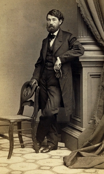
George N. Barnard
However, at least two well-known Civil War era photographers were both present in Nashville at the time of the battle. One of them was George N. Barnard (1819-1902), who served as official U.S. Army photographer for the Military Division of the Mississippi. The originals are now in the Library of Congress, and the dates indicate that some were made during the battle.
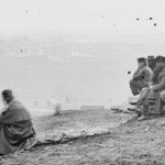
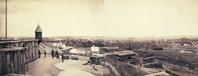
He got no closer to the field of battle than Fort Negley, which was several miles north of the Confederate lines located in the vicinity of present-day Woodmont Blvd. on Dec. 15, and present-day Harding Place/Battery Lane on Dec. 16.
The other was Jacob F. Coonley (1832-1915), a 32-year-old photographer who rushed to Nashville when he heard that Gen. John Bell Hood had moved the Army of Tennessee into the hills south of the city in order to engage with U.S. forces occupying Nashville. Coonley traveled around the city during the two days of the battle in a converted Federal ambulance wagon, making 10 stereo images. They consisted primarily of Nashville spectators or soldiers near the city. The closest he got to the action was Fort Casino, now the site of the Nashville Reservoir on Eighth Avenue, a distance of almost five miles from the Dec. 15 battle lines. Visit the FEATURES page on this website to read more about Coonley’s work in wartime Nashville.
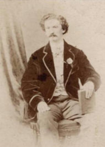
Jacob F. Coonley
Coonley had worked with the older Barnard at the start of his career, and both had worked with the Mathew Brady, perhaps the most well-known photographer of the Civil War era. There is some confusion, even within the Library of Congress archives, as to which photographer was responsible for certain December, 1864, photographs in Nashville (see photo captions below).
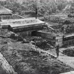
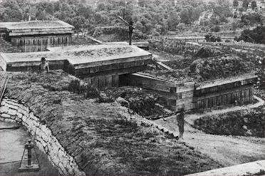
Two other photographers visited the battlefield more than 30 years after the action of December, 1864. In 1899, Dayton, Ohio attorney Albert Kern was in Nashville to photograph sites within the field of battle. Even though 35 years had elapsed since the conflict, and there had been some growth of trees and scattered new buildings, the battlefield was still largely unimproved, with dirt turnpikes, split rail fences, and large fields. In September, 2021, BONT obtained 12 of these images from Dayton History, and they remain the most contemporaneous photos of the blood-stained portions of the battlefield. To view these photos and read more about Kern, visit the FEATURES page of this website.
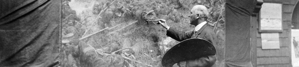
And finally, there remains historical intrigue about photographs that would have been made around the same time as Kern’s by the famous Delaware illustrator Howard Pyle (1853 – 1911). In 1906, Pyle painted a huge 6- by 8-foot mural of the battle at Shy’s Hill. It is located in the Governor’s Reception Room in the Minnesota State Capitol, as it was intended to depict the late-afternoon charge by Minnesota troops on Dec. 16, 1864.
Most important, however, is that Pyle apparently visited Nashville prior to starting his painting and took detailed photos of the area he intended to depict, as befit his reputation as a perfectionist in accurately portraying details in his illustrations. In a letter to the Minnesota capitol architect Cass Gilbert, he described the painting as follows:
“It had been raining during the latter part of the afternoon, but ceased a little before four o’clock. The order was given to charge and the advance was made across a sodden cornfield, and against a stone wall, behind which lay the Confederate line. In spite of the shot and shell which poured upon them, the Minnesota regiments dashed against the wall and over it, driving the Confederates before them. The Minnesota regiments were nearest the turnpike, and the viewpoint of the picture is taken at or near the juncture of the stone wall and the turnpike. The two regiments, becoming somewhat intermingled in the charge, rushed to breast-work at about the same time, and each planted its flag almost simultaneously upon the captured stonewall. The nearest regiment is the Fifth, and the flag in the middle distance is the flag of the Ninth, which perhaps was planted upon the captured wall a fraction of time before the other.”
Recognizing how important such detailed photos could be, author and BONT board member John Banks has searched for the photographs Pyle used for background, but to date, they have eluded discovery. John did find, however, that the Pyle painting is controversial in other ways. For a complete summary of his findings as well as other information about the Pyle mural, visit the SHY’s HILL page and scroll down to “Did Howard Pyle Get It Wrong? And Where Are His Photos?” You can also click HERE for his story on John Banks’ Civil War Blog.
Photographs by Jacob F. Coonley During the Battle of Nashville
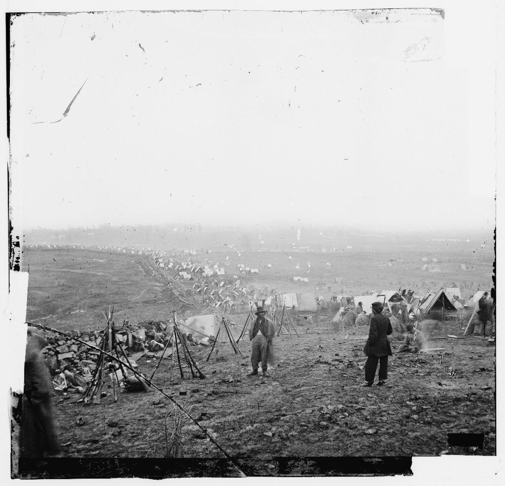 “Union outer line, December 16, 1864.” The southern defensive line of the Federal works during the Battle of Nashville shows how close the troops camped to their fortifications. The photo was probably made from the vicinity of Fort Casino. Much of the countryside south of Nashville had been cleared of trees to build fortifications, to use as firewood during the winter weather, and to provide fields of fire for the artillery. Photo attributed by Library of Congress to Jacob Coonley Coonley. The photo has been attributed to George Barnard in other sources.
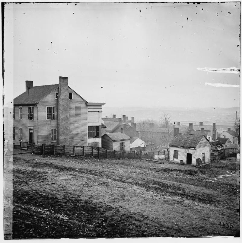
 “Federal Outer Line, Another View.” This view of the abandoned Federal line shows Fort Morton on the horizon to the right and the Franklin Pike running diagonally through the valley. The defensive works of the Federals were never attacked during the battle. Photo attributed by Library of Congress to Jacob Coonley Coonley, Dec. 16, 1864. The photo has been attributed to George Barnard in other sources.
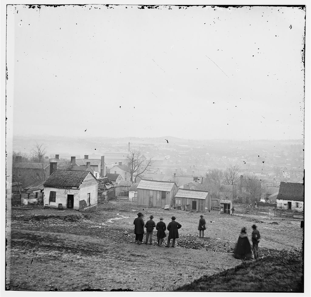
“Nashville. View of the City. Dec. 15, 1864.” Photo attributed by Library of Congress to Jacob Coonley Coonley. The photo has been attributed to George Barnard in other sources.
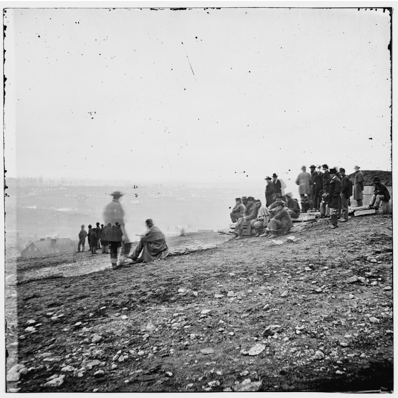
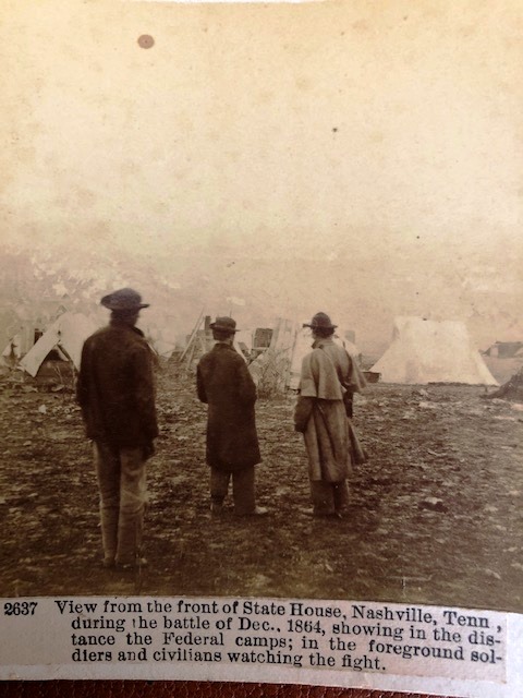
“Nashville Spectators watching the fight between Hood and Thomas, Dec. 15, 1864.” Photo attributed by Library of Congress to Jacob Coonley. The photo has been attributed to George Barnard in other sources.
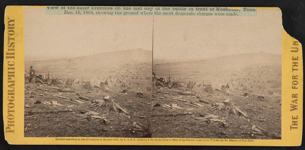
“View of the outer trenches on the last day of the battle in front of Nashville, Tenn., Dec. 16, 1864, showing the ground where the most desperate charges were made.” Attributed in the Library of Congress to Jacob Coonley & E. & H.T. Anthony
“View of Nashville from top of ____ Looking N.W. Military College, Dec. 15, 1864.” Photo attributed by Library of Congress to Jacob Coonley. The photo has been attributed to George Barnard in other sources.
Photographs by George N. Barnard During the Battle of Nashville
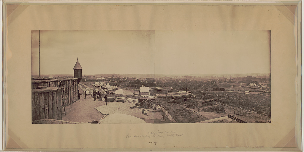
Panorama from Fort Negley. Photo attributed to George Barnard, Library of Congress, December, 1864
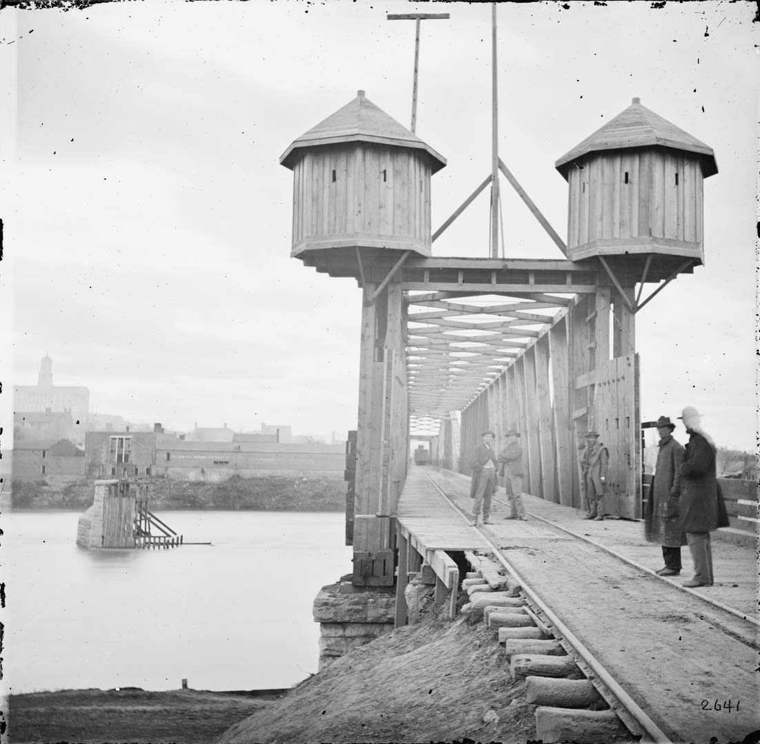
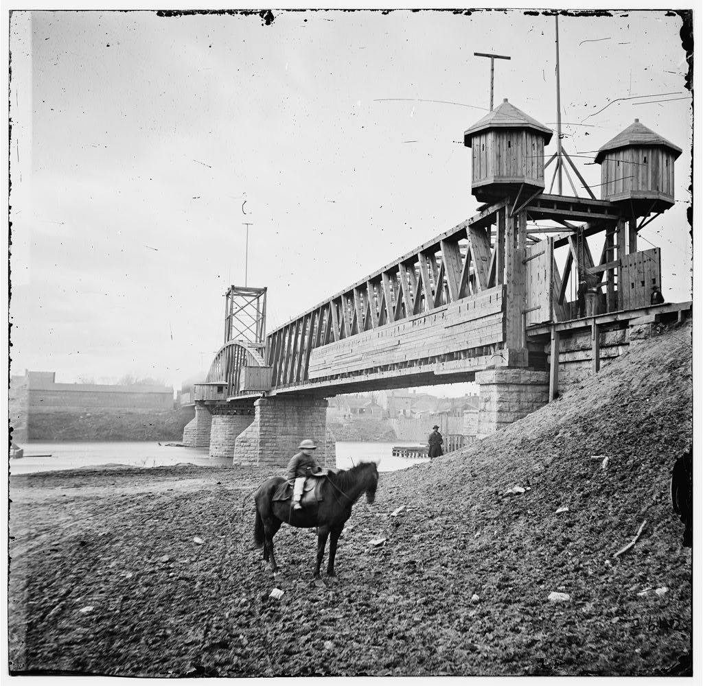 Fortified Bridge Over the Cumberland River
The swing-span bridge over the Cumberland River looking west toward Nashville from Edgefield. The bridge, built in the 1850s, could pivot around its central support to allow tall steamboats to pass. The Federals fortified the bridge with guard turrets, gates with loopholes, and sentries to protect the structure from raiders Nathan Bedford Forrest and John Hunt Morgan. Photo attributed to George Barnard, Library of Congress, December, 1864
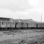
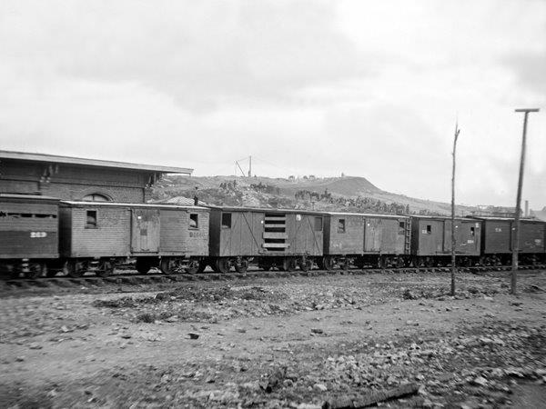
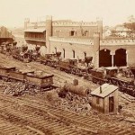
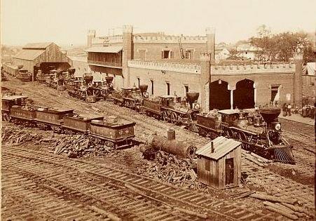
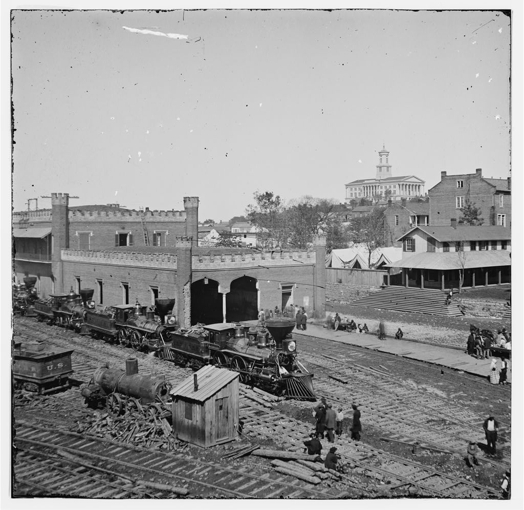 Railroad Yard and Depot
Locomotives in line at the Nashville and Chattanooga rail yard near Spring Street. In the distance is the State Capitol. Railroads were used extensively by the military during the war. The enormous Federal supply depot at Nashville was connected by rail with Louisville to the north, and Murfreesboro, Chattanooga, and ultimately, Atlanta, to the south. The railroad lines outside of town were favorite targets of Confederate cavalry raiders. Photo attributed to George N. Barnard, Library of Congress. Civil War Photographs, 1861-1865; Compiled by Hirst D. Milhollen and Donald H. Mugridge, Washington, D.C.; Library of Congress, 1977.
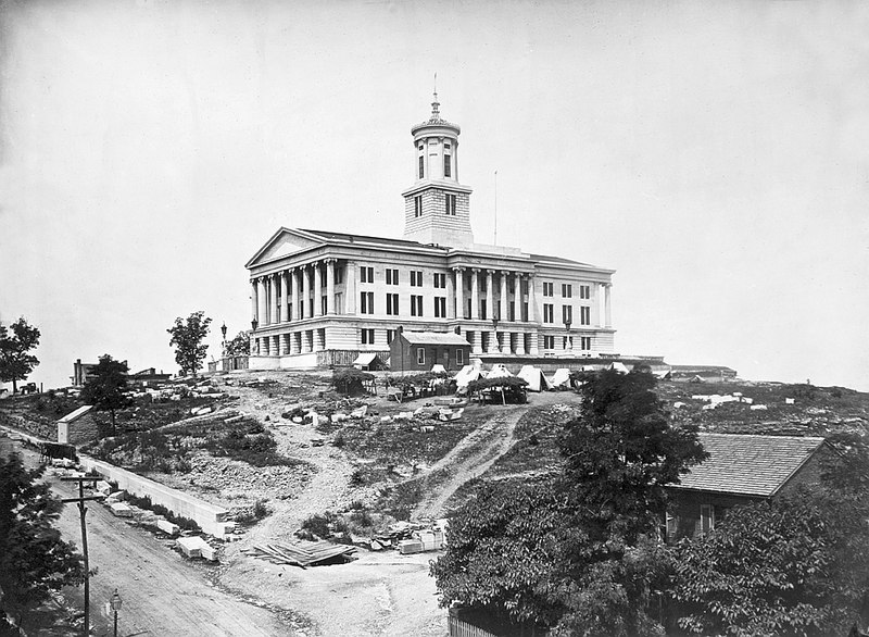
“Tennessee State Capitol, December, 1864.” Photo attributed to George Barnard, Library of Congress, December, 1864
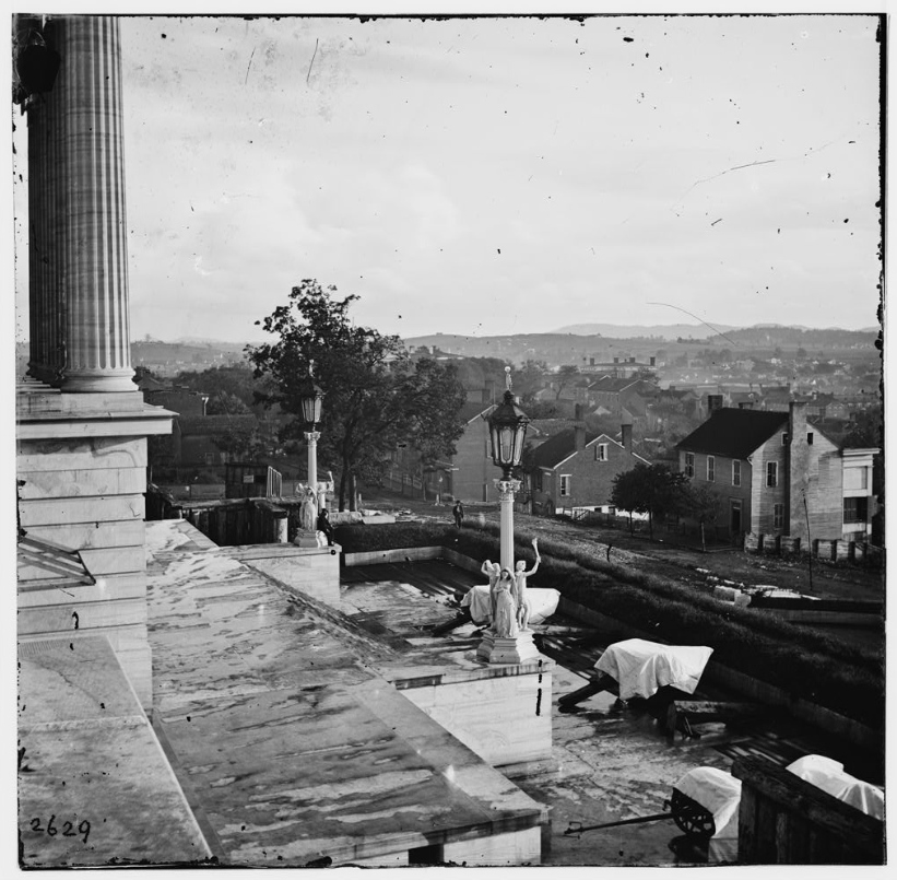
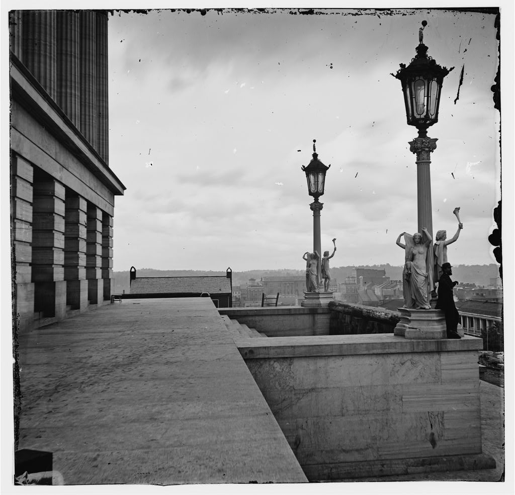
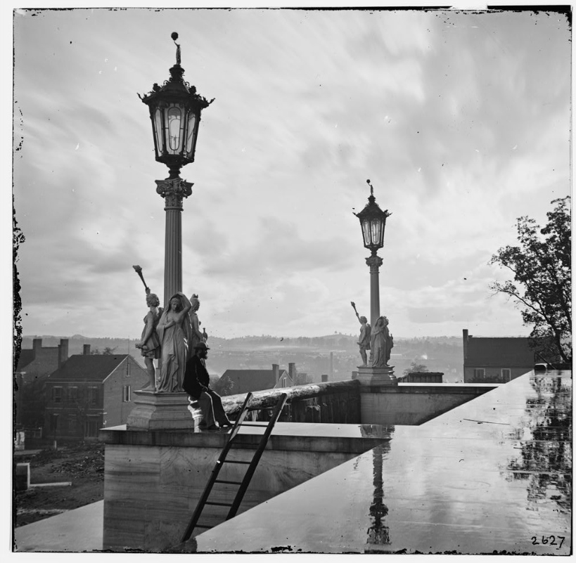
Tennessee State Capitol
“Steps of the Capitol with covered guns; vista of the city beyond” The Tennessee State Capitol building, completed in 1859, is the focal point of Nashville, situated on a high hill. The structure was fortified with heavy guns trained on the town and ground beyond and was known as Fort Andrew Johnson. This view from the north portico looks southwest toward the Polk Place. It has just rained, and the cannon have been covered with tarpaulins. Photo attributed to George N. Barnard, Library of Congress. Civil War Photographs, 1861-1865; Compiled by Hirst D. Milhollen and Donald H. Mugridge, Washington, D.C.; Library of Congress, 1977.
“Nashville, Tennessee. View from Capitol.” Photo attributed to George N. Barnard, Library of Congress.
“Nashville, Tennessee. View from Capitol.” Photo attributed to George N. Barnard, Library of Congress.
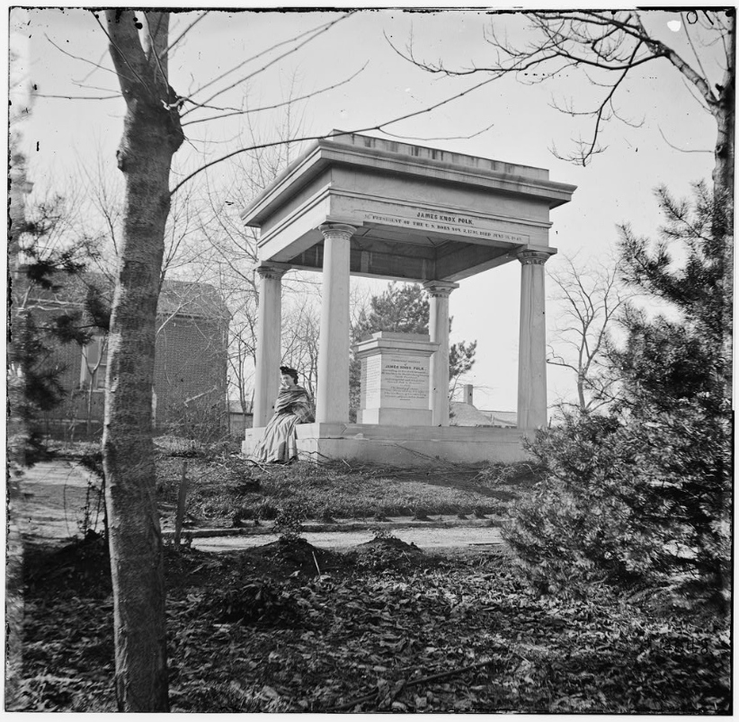
Tomb of President James K. Polk
The tomb of President James Knox Polk was located in the side yard of the Polk Place at Vine and Union streets in Nashville. As widow of a past president, Mrs. Polk was respected by the Union Army and the residence protected. Today, Polk’s tomb is located to the east side of the Tennessee State Capitol grounds. Photo attributed to George N. Barnard, Library of Congress.
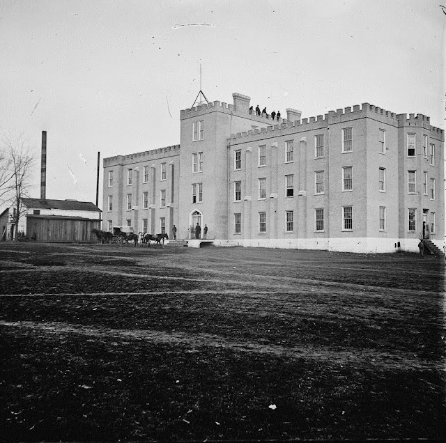
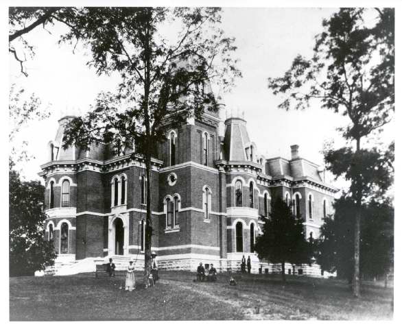
University of Nashville Used as Federal Hospital
This three-story brick building built in 1855, Lindsley Hall of the University of Nashville was used as a hospital by both armies. The foundation was white-washed with lime to prevent “contagion.” The main university buildings stood on College Hill, near the site of today’s Howard School. Many of the larger buildings in Nashville were used as hospitals by the Federals during their occupation. Photo attributed to George Barnard, Library of Congress, December, 1864
More Photos…
-
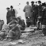
- Battle of Nashville spectators
-
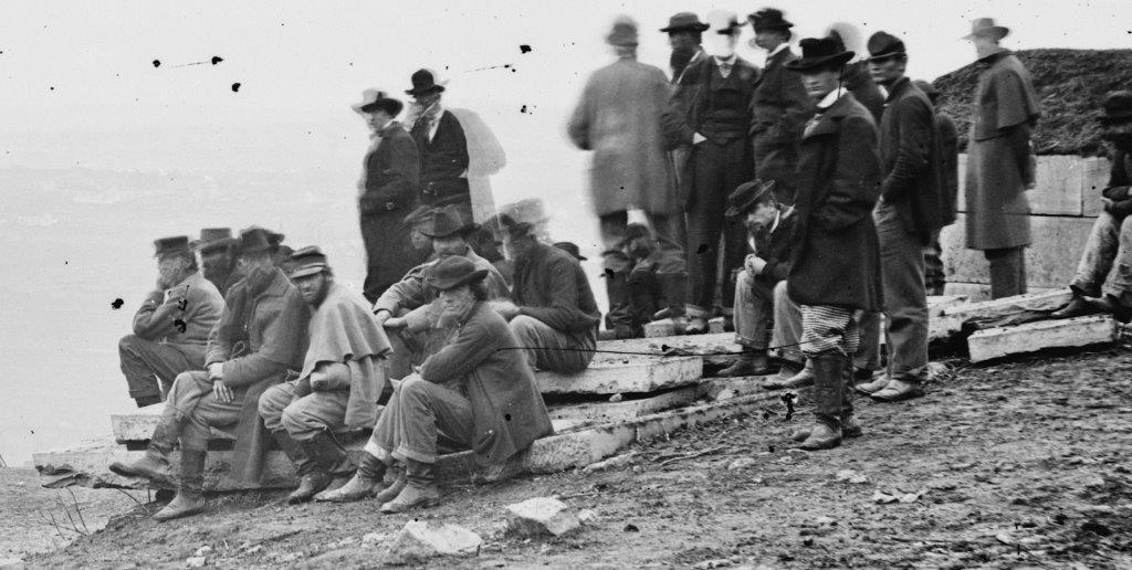
- Closer view of spectators

-
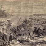
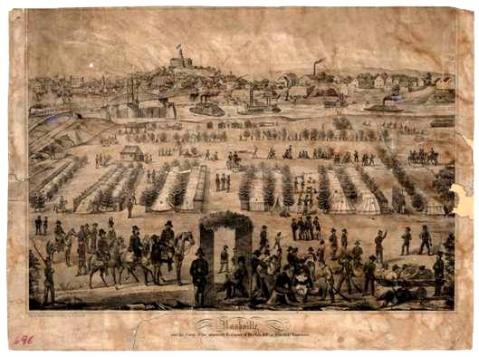
- Harper’s Weekly artist captures death of Union Col. Sylvester Hill of Iowa, killed by a sharpshooter during Union attack on Redoubt No. 3
-
- Chattanooga Federal cavalry guarding railroad depot,1864
-
- Edgefield during Civil War
-
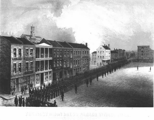
- Federal review in Nashville
-
- Ft. Negley during Civil War
-
- Nashville-Tennessee-Railroad-Depot-1864
-
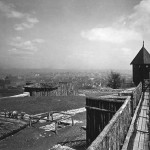
- Ft. Negley bastion
-
- Pyle working on Shy's Hill painting
-
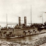
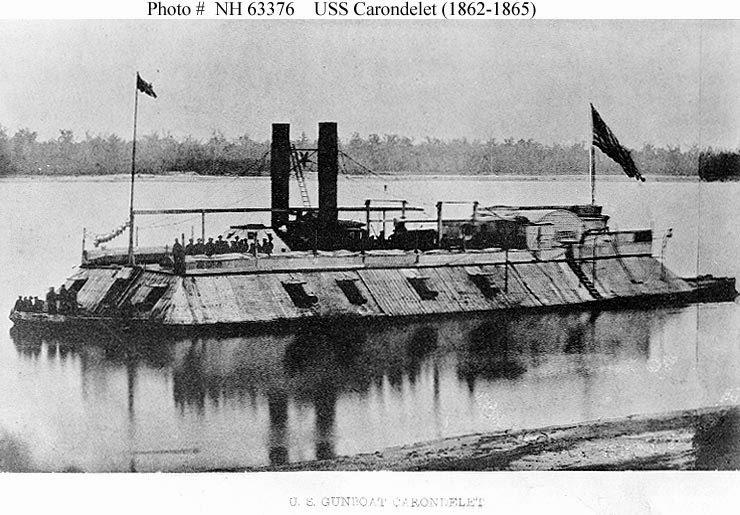
- USS Carondolet
-
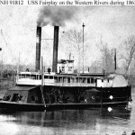
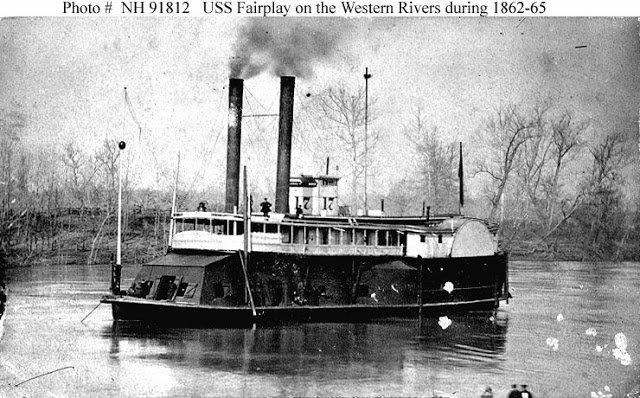
- USS Fairplay
-
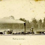
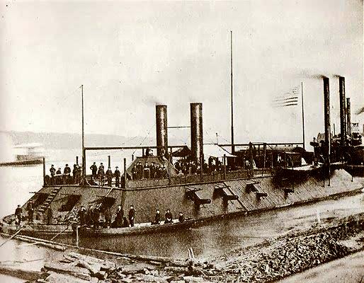
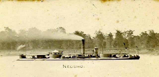
- USS Neosho
-
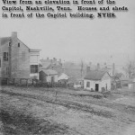
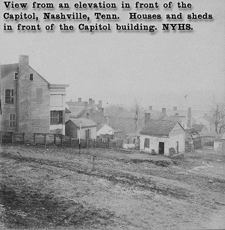
- View of Tennessee Capitol Building during Civil War
A Then-And-Now Look At the Photos Above
The YouTube video below, produced by The Nashville Tennessean, compares some of the best known vintage photographs taken in Nashville before and during the Battle of Nashville, with those same views as seen through a camera lens in 2020:
Dr. Stanley Horn
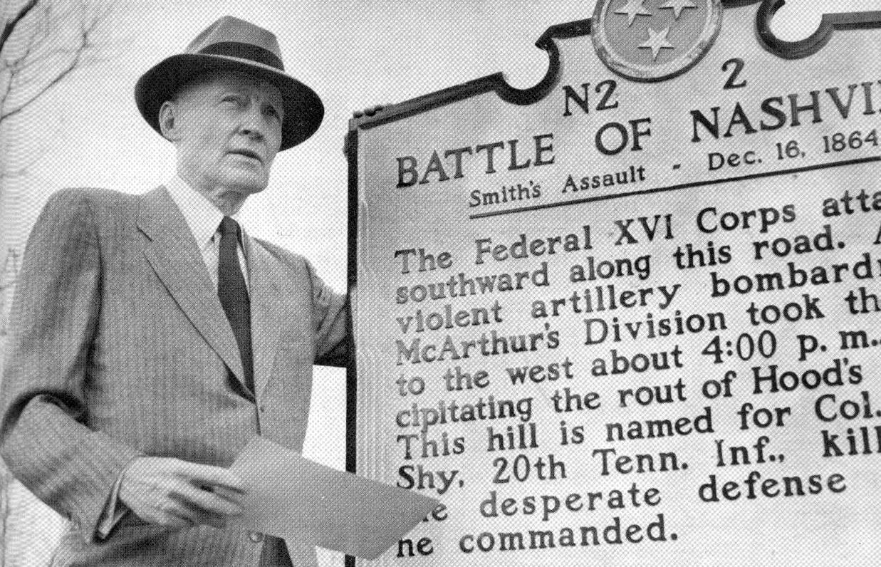
Above: Photo of Stanley Horn, taken during the dedication of the historical marker located at the corner of Granny White Pike and Battery Lane in 1964. Dr. Horn was a Nashville editor and businessman who authored nine books about the Civil War. In 1956 , he published The Decisive Battle of Nashville, the small book which many consider to be the definitive work on the battle, including its detailed descriptions of the officers, the armies, the battlefield and the course of the fighting both before and during the two days of conflict on December 15 – 16, 1864, and the impact of Hood’s Tennessee campaign and the Battle of Nashville on the war. Photo courtesy of our partner Tennessee Historical Society.
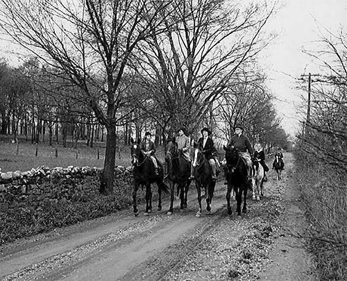
Photographs of Granny White Pike in 1935
Photographs of the Nashville Battlefield in the 1880s

Above: Shy’s Hill

Above: Bradford House

Above: Peach Orchard Hill

Above: Travellers Rest Plantation

Above: Looking Southwest of Granny White Pike

Above: Looking South toward the Brentwood Hills, possibly from the Lea Farm
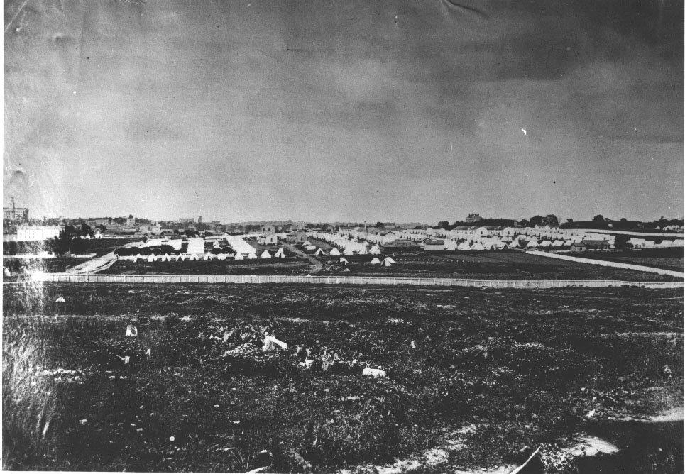
Above: Federal hospital camp on outskirts of city of Nashville, circa 1863 (note Capital building at far left of photo)
Above: 16th Illinois Infantry encampment in Nashville
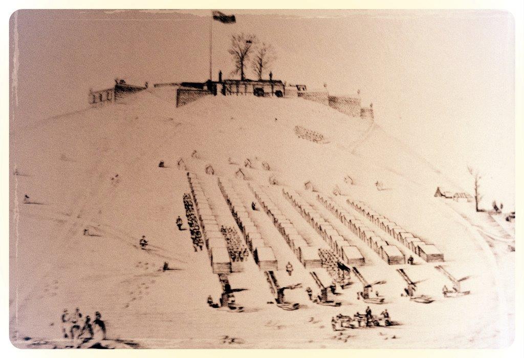
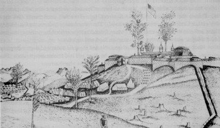
Above: Sketch of Fort Negley by an unknown Union soldier. Notice the troops camped on the slopes of the hill. Construction was performed mostly by freedmen labor.
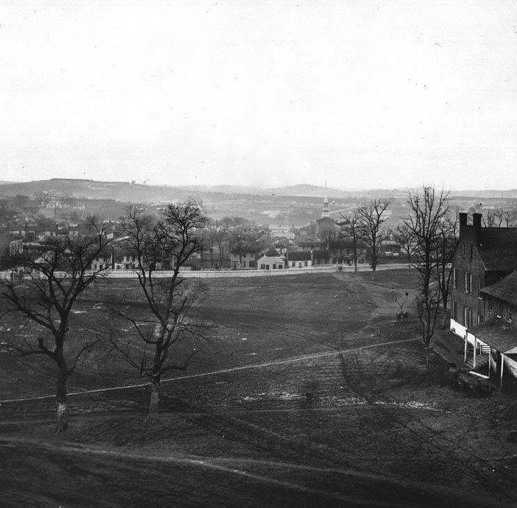
South Nashville, from the University of Nashville
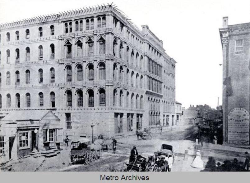
Above: The Maxwell House Hotel, located on the northwest corner of the current intersection of Church Street and Fourth Ave. N. in Nashville. Known during the time of the Battle of Nashville as the Zollicoffer Barracks, the hotel began construction in 1859 and had not been completed when Union forces occupied the city in 1862. At the time of the Battle, the hotel was being used as a Union barracks and prison for Confederate soldiers. After the Civil War, it became one of Nashville’s most celebrated hotels and landmarks, but was destroyed by fire on Christmas Day, 1961. The photo is in the Nashville Public Library collection and is dated “Circa 1865,” although some sources date it as early as 1864.
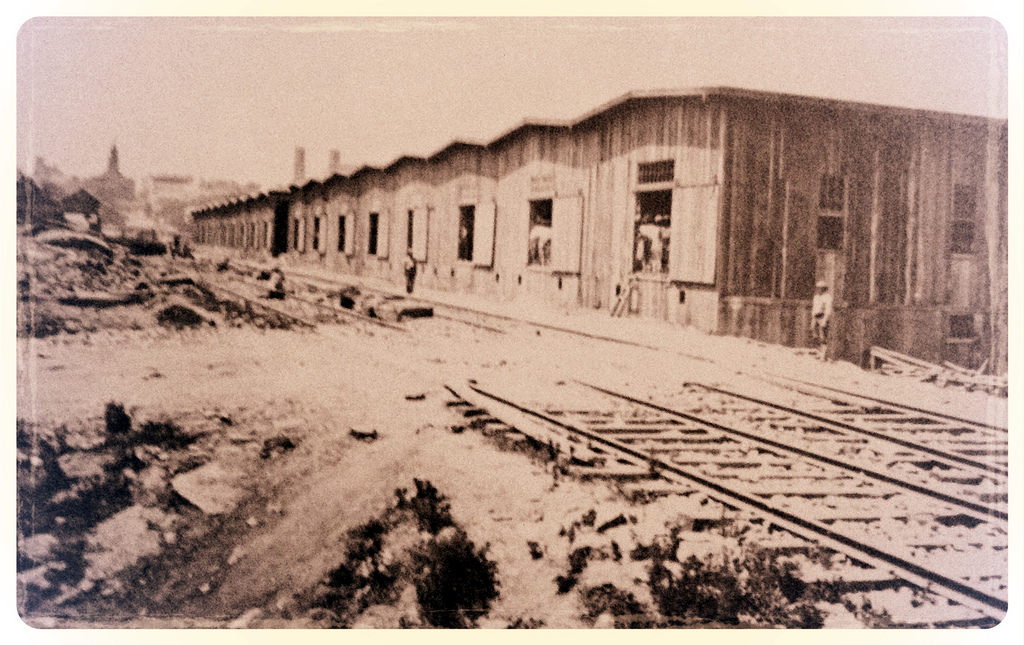
Above: Union supply depot located at the corner of Summer and Broad Streets in Nashville, facing the tracks of the Tennessee & Alabama Railroad. It was erected by Union troops to funnel supplies to their armies in the field south of Nashville.
Original photograph of Lea-Davis Residence, “Lealand.” Address: 1039 Tyne Boulevard. George W. Thompson 1889-1890. “Two red brick auxiliary buildings of the estate of the late Judge John M. Lea have been united and restored as a residence by the Rev. and Mrs. Paschall Davis. A 35-room mansion and auxiliary buildings, called Lealand, were built here in 1884, and the home was rebuilt following a fire three years later. Made of handmade brick faced with brown sandstone, Lealand had its own waterworks, gasworks and fire fighting equipment. Closed for 25 years beginning in 1912, Lealand was demolished in 1940 when the estate was subdivided. The home was built by Judge John M. Lea and his wife, the former Elizabeth Overton, daughter of Judge John Overton.” Excerpt from Nashville: A Short History and Selected Buildings, copyright 1974 by the Historic Commission of Metropolitan Nashville – Davidson County, Tennessee.
 _________________________________________________________________________